21/9/2020
By Asher – Out Doors’ Program Coordinator
The Victorian Government’s lockdown in response to the COVID-19 outbreak has been a tough journey for everyone – especially when it comes to mental health.
While Out Doors Inc can’t run our regular outdoor adventure and recreational programs, we do want to support the community and help people with their mental health challenges.
Introducing: Walking Maps of Melbourne!
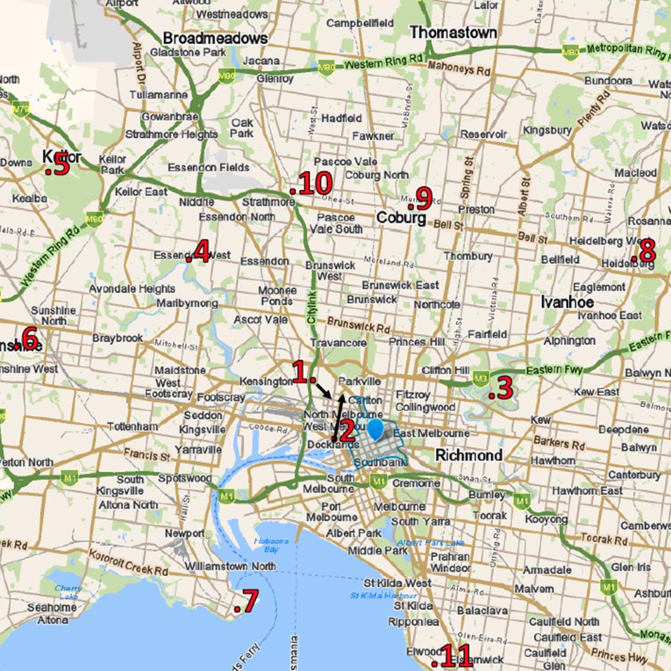
With lockdown restrictions starting to ease, we’ve put together 12 different walking maps for different suburbs in Melbourne – from Moonee Ponds to Merri Creek, Bundoora Park to Sandringham Beach.
Note: please always observe lockdown restrictions. You can find up to date information on what you can and can’t do during the lockdown on the Victorian Government’s coronavirus (COVID-19) website.
Each map takes you to a new place, with new experiences in nature and different levels of difficulty – easy, moderate and hard.
Downloadable Maps
Click the links below to download your maps and get started!
You can also download a handy guide by clicking here.
- Royal Park / North Melbourne – 3.4km Return – Easy
- Princes Park / Carlton North – 3.2km Loop – Very Easy
- Yarra Bend Park / Kew – 3.5km Return – Hard
- Maribyrnong River / Essendon West – 8km Loop – Easy
- Brimbank Park / Kealba – 6.75km Return – Moderate
- Kororoit Creek / Sunshine – 7.6km Out and Back – Easy
- Coastal Trail / Williamstown – 8km Return- Easy
- Yarra River Walk / Heidelberg – 5.5km Loop – Easy
- Merri Creek Explore / Coburg – 5.2km return – Easy
- Moonee Ponds Creek Trail / Pascoe Vale – 7km Return – Easy
- Red Bluffs on Sandringham Beach / Sandringham – 5km Return – Easy
- Bundoora Park / Bundoora – 5.5km Loop – Moderate
Note: please always observe lockdown restrictions. You can find up to date information on what you can and can’t do during the lockdown on the Victorian Government’s coronavirus (COVID-19) website.
If you have questions or comments about this article, please contact us.


Post a comment